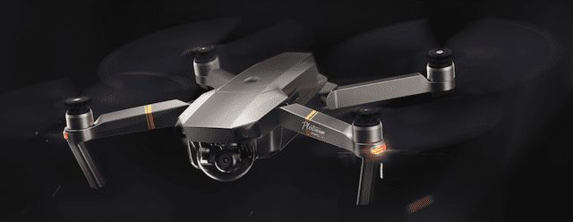
Drones — those remotely-piloted multi-rotor “copters” or airplanes that usually carry a camera — are becoming more and more popular, so there may be a good chance that you either have one or are thinking about buying one for the upcoming holidays. Whether you’re flying for pleasure or you’ve decided to take on a new job as a commercial drone pilot with an FAA Part 107 certificate, there are a number of apps available to Apple users to help you get in the air and hone your skills when you’re not flying.
Mac Apps:
There are a lot of iOS apps for potential and existing drone pilots, but we’ll start off with some notable Mac apps.
Zephyr Drone Simulator
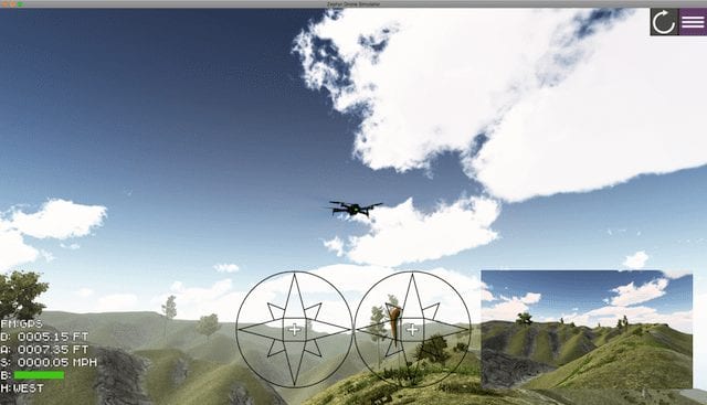
Want to build and maintain flying skills without crashing an expensive drone? Zephyr Drone Simulator is a perfect way to keep your skills razor-sharp, even when conditions outside are keeping you grounded. This Mac (and Windows) app can be purchased as a standalone app (US$99.99), bundled with a controller with a USB input ($139.99), or used with any existing drone controller with a USB output ($109.99 with USB adapter).
The app lets you switch between different drones and uses the flying characteristics of each. At this time, Zephyr Drone Simulator supports the DJI Phantom 3, Inspire 1, and Mavic Pro, 3DR Solo, Syma X5C, Autel X-Star, and Parrot Bebop 2 drones. While it’s fun to fly this as a game, it’s really set up as a training system with a complete learning management system built in. A number of training scenarios — with or without weather — are provided to give pilots practice in learning flying skills and you’re given a grade based on accuracy, speed, and control.
Drone Pilot (UAS) Test Prep
To become a commercial small unmanned aerial system / drone “remote pilot in command” in the United States, you need to pass a Federal Aviation Administration exam. That exam covers regulations, airspace and requirements, weather, loading and performance, and operations, and if you’re not familiar with aviation, it can be tough to get the 70% score required to receive your FAA certificate. Drone Pilot (UAS) Test Prep ($54.99) is good for learning the required material and for soothing your nerves prior to the test.
iOS Apps:
Hover
One of my personal favorites, Hover, is a free app that provides maps, weather data, a way to create flight logs for individuals and teams with multiple drones, a flight readiness indicator that immediately lets you know if it’s safe to fly a drone both by location and weather conditions, and a news feed of drone-related news.
Hover Camera
Many small “dronie” drones — used to take selfies from the air — have their own apps and are controlled by your iOS device. The best example of one of these apps is Hover Camera, which works with the Hover Camera Passport drone. With the new Owner Mode on this little intelligent drone, you can use the app to recognize you and train the drone, which can then follow you or respond to your gestures.
AirMap
For those who are FAA-certificated drone pilots, AirMap is an essential part of your toolbox. This free app lets you access airspace advisories, file digital notices, manage aircraft, and more. Get a flight weather briefing, see real-time traffic alerts, and fill out checklists before a flight. The app usually gets rating of 4 stars on the iTunes App Store. Soon, US Part 107 pilots will be able to request automated FAA airspace authorization to fly in controlled airspace with the app (currently being tested in Cincinnati, Lincoln, Reno, and San Jose).
LiveATC
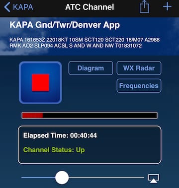
Professional drone pilots may need to be in contact with a control tower or pilots during a flying session, and LiveATC ($3.99, see screenshot above) is a great way to learn the lingo of both pilots and controllers worldwide as they orchestrate the arrival or departure of aircraft. Fascinating even if you’re not a pilot!

UAV Forecast
You can’t do much flying if the weather is horrible, and UAV Forecast (see screenshot above) is probably the best weather app for drone pilots. The free app provides a simple and immediate “Go / No-Go” warning with details on weather conditions including wind (speed and direction), wind chill, precipitation probability, cloud cover, visibility and even geomagnetic activity (important because it can play havoc with drone navigation). The app also displays how many GPS/Glonass satellites are visible and how many your drone is locked onto, and will warn of any nearby no-fly zones or temporary flight restrictions.
WindAlert
One of the few things that can ground a drone pilot is severe wind, and the free WindAlert app (with in-app purchases) provides real-time wind reports from over 50,000 weather stations worldwide. A simple map shows speed and direction of wind near you, or you can look at trends or detailed forecasts for specific locations.
DJI Go 4
Have a DJI drone? You definitely need DJI Go 4. This app can be used with the Phantom 4 Series, Mavic Pro, Spark and Inspire 2 drones, to work alone or with a DJI controller. To quote the app description, “It provides near real-time image transmission and camera settings adjustment, as well as editing and sharing of aerial imagery.” In reality, it does much more, providing automatic flight logs, and a built-in flight simulator and pilot academy. Best of all? It’s free.
DJI Ground Station Pro (GS Pro)
For DJI drones (Phantom 3 Standard/4K/Advanced/Professional, Phantom 4/Pro, Inspire 1/Inspire 2, Matrice 100/600/600 Pro, A3, N3, and Mavic Pro), GS Pro is used to control or plan automatic flights while automatically taking photos at pre-set waypoints. The free app has some in-app purchases available that make it possible to import KML/SHP/KMZ files for setting up virtual 3D fences or mapping flight paths.
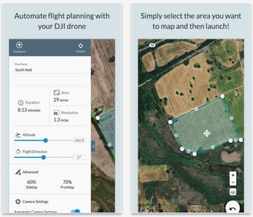
DroneDeploy
DroneDeploy (see App Store description above) is a cloud software platform for drone mapping and 3D modeling. This free app works with the DroneDeploy service to automate flight planning with most of the DJI drone line, leading to complete automated flights and capture of map data.
MapPilot
Like DroneDeploy, MapPilot is used to create and fly optimal flight paths for creating maps using the Maps Made Easy map processing service. The app is $9.99, and supports most DJI drones with the exception of the Spark. One nice feature is that No Fly Zones are displayed both online and offline, and the pilot does not need to be connected to the aircraft to do flight planning.
Prepware Remote Pilot
Studying for the FAA Remote Pilot (Unmanned Aircraft General – Small) FAA Knowledge Exam? The $4.99 Prepware Remote Pilot app provides questions, answers and explanations for the exam and is a perfect accompaniment to other study materials.
Are you a drone pilot with a favorite app not listed here? Let us know what it is by leaving a note in the comments below.
